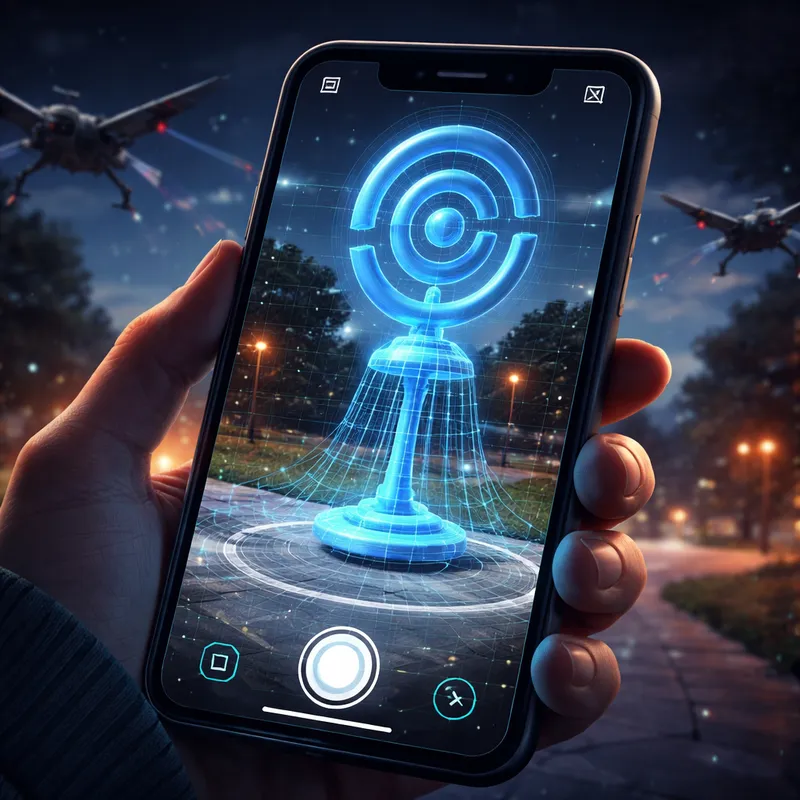
Pokémon Go scans and military drones: why this story blew up in 2026
Pokémon Go scans and military drones became a hot topic after reports claimed Niantic's scans being used for military drone navigation may have helped train systems for GPS-denied navigation. The core idea is simple: Pokémon Go players who scanned their surroundings for in-game rewards may have contributed data that later helped visual navigation tools. Some reports go further and say roughly 30 billion environmental scans acquired by Niantic through Pokémon GO fed technology now linked to military drones.
That is a serious claim. But when you dig into the reporting and community debate, the picture gets more complicated.
The short version is this: a dual-use pathway looks plausible, but the strongest headline version is still disputed. Niantic reportedly said Pokémon Go scans helped train an early version of its model. A defense partner reportedly said it would not use Pokémon Go data directly, while also declining to fully clarify whether earlier model training included such data. So if you are trying to understand what this really means, you need to separate three things:
- what Pokémon Go actually collected,
- what visual positioning systems can do,
- and whether that equals battlefield-ready drone mapping.
What Pokémon Go was actually scanning
A lot of people hear this story and imagine Pokémon Go quietly building a full 3D copy of entire cities. That is probably too broad.
According to the reporting and the technical discussion around it, the scanning feature was mostly tied to PokéStops. Players could walk around a location, record a short video, and get in-game items. These scans were optional, and separate permission was reportedly required for Niantic to retain the footage.
In practice, that matters. A PokéStop scan is not the same thing as continuous street-level mapping across every block. Commenters in the discussion described the output more like small localized 3D bubbles around landmarks rather than a dense, complete world model.
Think of it like this: if you scan a statue in a park, a mural on a building, or a church entrance, you get useful visual information around that spot. But you do not automatically get full coverage of the neighborhood, the rooftops, the side streets, or the aerial views a drone might need.
That is one of the main reasons people called the original headline sensational.
What the reports actually claim about Niantic data
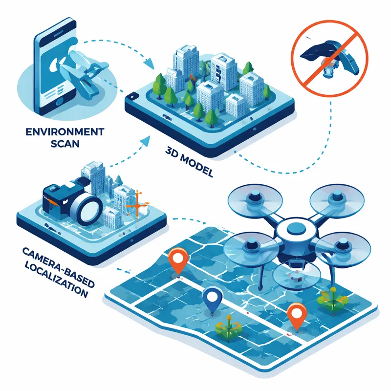
The strongest reported claims say Niantic gathered millions, and possibly roughly 30 billion environmental scans, through Pokémon Go and used them as raw material for a Visual Positioning System, or VPS. VPS helps a device figure out where it is by comparing what its camera sees to a 3D model or learned visual features of a place.
The reported chain looks like this:
- Players scan physical locations.
- Niantic Spatial turns that input into 3D map data or training material.
- That navigation technology is then adapted for robots, vehicles, AR systems, or drones that need to work when GPS is weak, jammed, spoofed, or unavailable.
On its face, that pipeline is not crazy. Visual localization is real. GPS-denied navigation is a real military and civilian problem. Dense cities, tunnels, signal jamming, and electronic warfare all make satellite navigation less reliable.
What is still debated is the leap from "players contributed useful scan data" to "Pokémon Go directly powered military drones in war zones."
Why visual positioning matters for drones
If you want the basic technical case, it goes like this.
A drone or robot can use a camera to compare live imagery against known features in the environment. If the system can recognize enough points, it can estimate location even without GPS. Some reporting described this as needing only a few recognizable reference points spanning a small number of pixels.
That makes sense in principle. A ground robot, AR headset, or drone could all benefit from localization software that says, “I know where I am because I recognize this building edge, this road pattern, and this landmark.”
This is why people take the story seriously. Even sparse ground-level scans may still help train models that learn how to match visual features, relocalize after drift, or perform better in camera-based navigation tasks.
So yes, there is a plausible dual-use case here.
Why skeptics say the military drone headline is overstated
The skepticism is not about whether visual navigation exists. It does. The skepticism is about scale, coverage, and causation.
Here are the biggest objections raised in the debate:
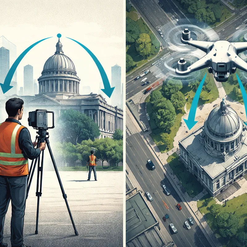
1. PokéStop scans are sparse
The scans appear tied to specific points of interest, not a full continuous map. That makes them useful for landmarks, but not automatically useful for broad route planning across large areas.
2. Ground-level footage is not the same as drone-view imagery
A pedestrian circling a PokéStop captures a very different perspective from a drone flying overhead. Some commenters argued that military drone localization may need top-down or multi-view data that Pokémon Go scans do not naturally provide.
3. Conflict-zone overlap may be limited
One of the most repeated points in the discussion was simple: where Pokémon Go scans exist may not overlap much with active drone-heavy theaters of war. Even if a model learned from civilian scans, that does not prove it had useful place-specific coverage in real combat areas.
4. Training data is not the same as an operational database
This is important. A model can be trained on one kind of data and then used elsewhere. If Niantic data trained an early version of a localization model, that does not mean a deployed drone is literally navigating by pulling from a Pokémon Go map of that battlefield.
That distinction gets lost in viral headlines.
The Niantic Spatial and Vantor angle
A big reason this story moved beyond theory is the reported partnership between Niantic Spatial and Vantor in late 2025. The partnership was described as combining ground localization and aerial localization so drones, vehicles, and operators could share the same coordinates in real time without satellite signals.
That sounds very relevant to military drones. It is also where the public ambiguity starts.
Reportedly:
- Vantor said it would not use Pokémon Go data.
- Vantor also declined to fully clarify whether earlier model training used that data.
- Niantic said Pokémon Go scans trained an early version of its navigation model.
- Niantic reportedly had no new details to share about the defense partnership itself.
That leaves you with a narrow but important possibility: Pokémon Go scan data may have contributed to earlier model development, even if the final deployment stack uses other data sources later.
If that sounds slippery, it is. But that is also how model training often works. Once data is baked into model behavior, tracing exactly what came from where gets hard.
What this means for consent and trust
This is where the story stops being technical and becomes personal.
If you scanned a PokéStop for a few extra items, you probably thought you were helping a game improve AR or map a landmark for gameplay. You probably were not thinking about defense contractors, military drones, or GPS-denied battlefield navigation.
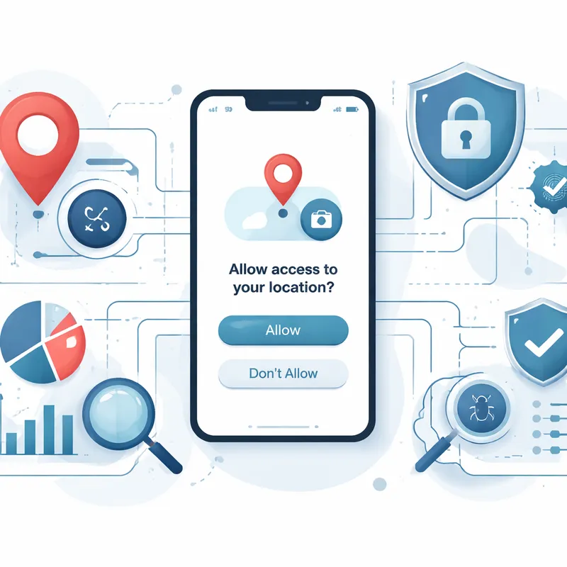
That does not automatically mean data was taken without any notice. Reports say the scans were optional and required separate permission for retention. But legal permission and informed understanding are not the same thing.
That is the real controversy with Pokémon go data collection. People may have clicked yes, yet still had no realistic picture of how widely licensed, repurposed, or commercialized that data could become later.
And this is not just a Niantic issue. The same dual-use concern applies to smart glasses, AR hardware, robot cars, and any product that turns everyday user behavior into spatial data.
So, did Pokémon Go scans train military drone navigation tech?
The most honest answer is: maybe in part, but the viral version is stronger than the evidence clearly shows.
Based on the reporting summarized here, you can say a few things with confidence:
- Pokémon Go had an optional scanning feature tied to real-world locations.
- Niantic reportedly used scan data to train an early navigation model.
- Niantic Spatial later entered a reported partnership with a defense-linked company focused on GPS-denied localization.
- There is a plausible technical path from consumer spatial data to drone navigation systems.
But you should also say this:
- Sparse PokéStop scans are not the same as a complete battlefield map.
- Public evidence does not clearly prove that Pokémon Go data directly powers current military drones in active war zones.
- The most dramatic headlines blur the difference between contributing training signals and providing operational navigation coverage.
My take: the story matters, even if the clickiest framing is too neat. The real lesson is not that Pokémon Go secretly became a drone program overnight. It is that consumer data pipelines are often wider, longer, and more military-adjacent than users expect.
What users should watch going forward
If you care about privacy, AI, and military use, keep your eye on a few practical questions:
- What exact data is collected when you scan?
- Is retention optional or automatic?
- Can that data be licensed or sold to third parties?
- Are companies separating consumer AR uses from defense uses?
- Can users meaningfully revoke or delete spatial data later?
These are better questions than just asking whether one headline was exaggerated.
FAQ
Why did China ban Pokemon Go?
China did not broadly embrace Pokémon Go because of regulatory, mapping, and security concerns. Reports over the years have tied restrictions to geolocation controls, content approval rules, and worries about location-based games interacting with sensitive mapping data. In short, the issue was less about Pokémon itself and more about digital maps, real-world movement, and state control.
Has Pokémon Go's popularity declined?
Yes, compared with its 2016 peak, Pokémon Go's popularity has declined. That said, it still has a large player base, regular live events, and strong brand recognition. A game can be past its peak and still remain commercially important for years.
Can I trick Pokemon Go into thinking I'm walking?
Some players try location spoofing, GPS drift tricks, or device automation, but doing that can violate Pokémon Go's rules and may lead to account penalties. It is also unreliable. If your goal is to play safely, it is better to use normal movement and in-game features rather than hacks.
What is the controversy with Pokemon go data collection?
The hit mobile game Pokémon GO has come under scrutiny following claims that images captured within the app may have been used to train AI systems developed by its creator, without players' consent. However, these images were not collected entirely without users' awareness. The controversy is really about whether users truly understood how optional scans, uploaded footage, licensing terms, and future third-party uses could connect to things like mapping systems, AI training, or even military drones.
Final takeaway
If you came here looking for a clean yes-or-no answer, that is the frustrating part. The data story is not clean.
Pokémon Go scans may well have helped train early visual navigation tools. That is plausible and partly supported by the reporting. But the idea that Pokémon Go created a giant battlefield-ready map for military drones is not clearly established by the evidence summarized so far.
In 2026, the smarter takeaway is this: when an app asks you to scan the world, you should assume the data may travel much farther than the game itself.

